The drone's aerial perspective has people constantly exploring new uses for it, thermal imaging drones are unlocking wildlife management for detecting animal populations, protecting endangered species and conservation, tracking and mitigating invasive species, providing rapid reconnaissance, tracking Livestock etc.
Monitoring animal populations
Drones can capture images from a bird's-eye view, giving them an advantage over traditional field research.
Much more accurate at counting species and can record large amounts of data faster than humans.
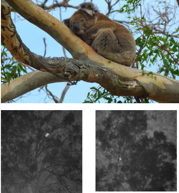
Thermal imaging drones are more useful for animals that are good at camouflaging and hiding themselves in nature, such as koalas. Advanced thermal drone sensor technology surveys these mysterious creatures from the air, detects the thermal signature of koalas, makes the invisible visible, quickly conducts large-area surveys with real-time visual and spatial data, improves data quality, and sees animal locations in real time.

U.S. Agriculture's Fight Against Wildlife Invasion Animal Wild Boar Herds
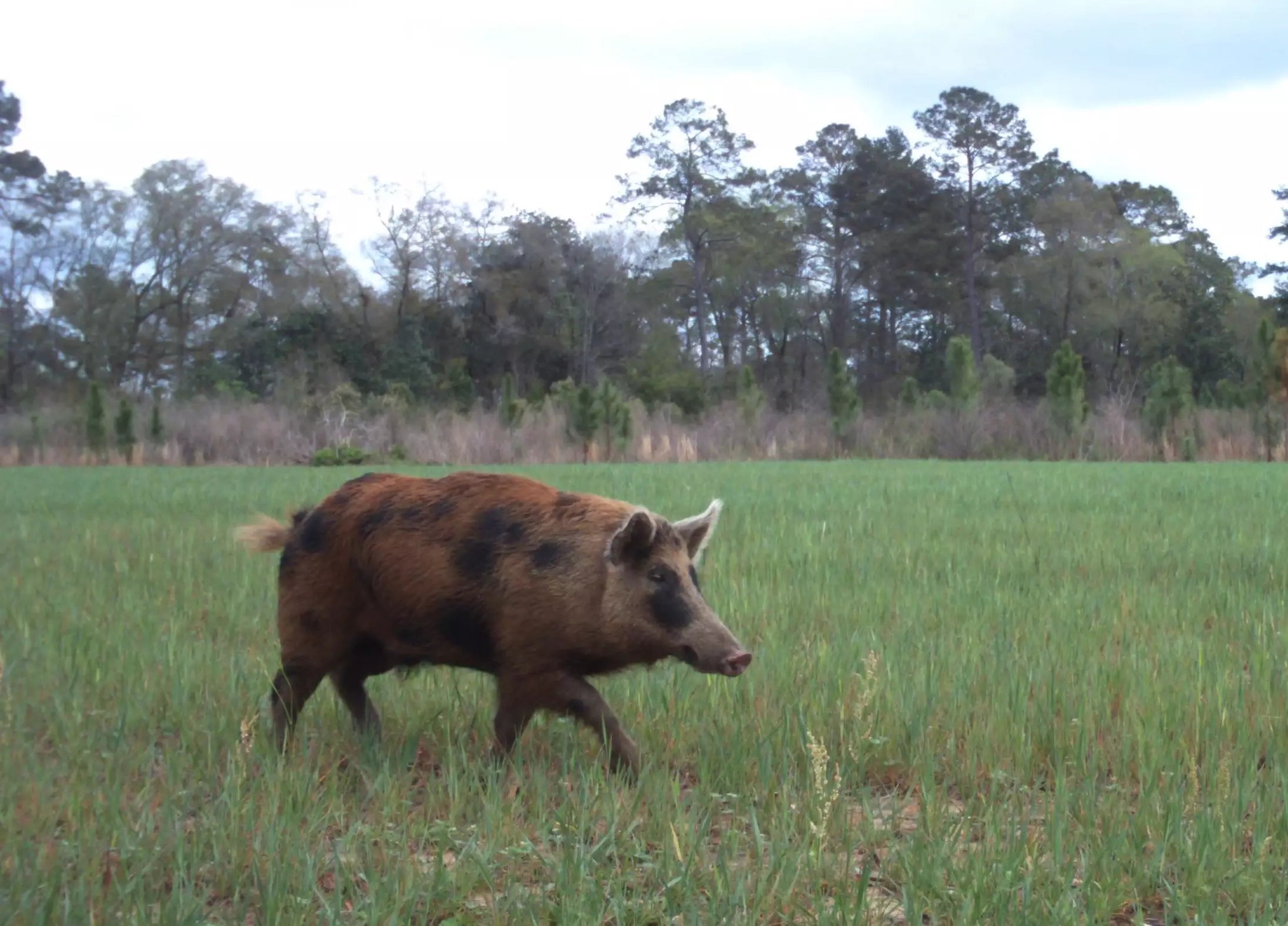
In the United States, wild boars are a highly invasive invasive species, not only competing with native wildlife for food and water, but also destroying established and regenerating habitats. The associated damage and containment costs can exceed $1.5 billion annually. The range of wild boars has expanded to 39 of the 50 U.S. state territories.

The damage wild boars do to native species and ecosystems is staggering. This includes direct predation on nests, eggs and young of native ground-nesting birds, reptiles and amphibians, and increases the risk of disease transmission. Also included are impacts on threatened species and birds such as wild turkeys, grouse and quail.
At the same time, wild boars are also surprisingly destructive to farms. They wantonly break up the land, looking for plant tubers and seeds in the soil to feed on. Farmers often lose a lot, and there is nothing they can do about it.
The thermal camera drone 640T can detect and locate multiple marked individuals and species in one place at the same time, and can set dynamic tracking to focus on search work. This saves time and effort for wild boar population detection compared to manual traditional radio tracking on the ground.
Monitoring and counting livestock
Farm producers want the best possible care for their livestock. This is why thermal imaging drones are also used to locate and monitor farm animals.
This is the most practical smart farming. Quickly and remotely view animal locations to track their welfare, calving season and grazing patterns. You can also plan more time-efficient and cost-effective collections.
Practical Farm Management

One drone, multiple applications and sensors, thermal camera drones offer producers a cost-effective and time-saving option. Locate animals in real-time, track lost livestock, even beyond fences, improve livestock safety, and quickly search wide areas to determine the location of stolen animals.
Drone platforms can also be deployed to automatically monitor and collect data on other assets such as watering points, soil moisture meters, fences, etc. The application of drones on farms can save a lot of time, energy and money, and help reduce labor costs.
Fighting Wildlife Crime
Drones can be effectively used to predict, locate, track and catch suspected poachers to reduce the number of animals killed due to the illegal wildlife trade. Poaching activities such as rhino horns and ivory have been banned repeatedly. No less than 500 rhinos and elephants are illegally hunted every year. A kilogram of rhino horn reportedly sells for about $150,000 a kilogram on the black market. Profiteering has made rhinos precarious.


Thermal imaging drones can spot poachers in wildlife refuges, day or night. Thermal imaging drones could help anti-poaching units cover larger protected areas in less time. In 2012, Google gave $5 million to the World Wide Fund for Nature (WWF) to buy conservation drones to fly over parts of Africa and Asia in an attempt to help monitor and catch wildlife poachers.
In addition to spotting, tracking and deterring poachers, drones can play a broader conservation role. Drones equipped with multiple sensors and cameras can be used strategically for surveillance, data collection, and censuses of flora and fauna.
Save endangered species
The illegal trade of wild animals has put many animals at risk of extinction. Pangolins are one of the most trafficked mammals in the world, drones can transmit signals over long distances and navigate dense and rugged terrain, and thermal imaging drones improve surveillance capabilities, track multiple animals, and overcome tricky conditions terrain.
Drones study marine animals
The boom in drone technology is also helping professionals in the study of marine animals. The images and data they collect can tell us a lot about animals and possible conservation techniques. Using drones to study marine animals clearly offers the potential to study a wide variety of taxa. One of MDPI's papers, "Operational Protocols for the Use of Drones in Marine Animal Research," focuses on the use of drones to study marine animals, showing the promise of examining many aspects of their ecology, behaviour, health and movement patterns.
The choice of thermal imaging drone
Opting for thermal imaging drones or drones with thermal sensor technology for wildlife management is very feasible. Drones like these can be used to improve the way animals are tracked and understood, and experience the future of animal tracking. Quickly survey wide areas and safely access rugged and remote terrain from the air, track multiple animals and see their locations in real time.
In the Autelpilot store, you can choose the EVO II 640T as your auxiliary. EVO II 640T has dual cameras, which are composed of 8K visible light camera and 640*512 resolution thermal imager.

The thermal image of EVO II 640T is 4 times that of ordinary thermal drones 160*128, and 2 times that of a single-tube infrared sight 320*256. EVO II 640T adopts picture-in-picture mode to view thermal images. The superposition of RGB images and thermal images allows professionals to view the target position more clearly and track and locate wild animals.
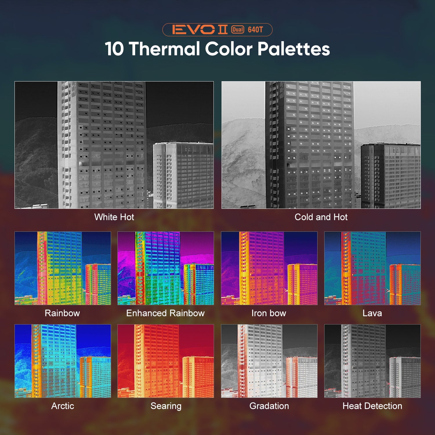
EVO II 640T can also use 10 kinds of thermal palettes and multiple temperature measurement modes. The temperature measurement accuracy can be effectively used in harsh environments with little impact. The flight time of EVO II 640T can reach 38 minutes, and a patrol can reach 25km. With 8-level wind resistance, it can be used in professional drone deployment programs to achieve wildlife management.

One of the greater strengths of the EVO II 640T is the ability to perform photogrammetry. In the EVO II 640T RTK drone, photogrammetry obtained from the drone can produce measurements with an error level of <1 cm. The Ground Sampling Distance (GSD) is a key factor limiting the accuracy of photogrammetry and the difficulty of detecting organisms. The EVO II 640T has an 8k 48MP camera sensor lens that can perform 4x lossless zoom. This advancement can be achieved by adding more details to enhance the detection of organisms.
 Effect of camera resolution on ground sampling distance height
Article Source:https://www.autelpilot.com/blogs/news/autel-evo-ii-640t-thermal-drones-for-wildlife-management


