Volcanoes are one of the most striking landscapes on Earth. Although volcanic eruptions can bring catastrophic damage, they also provide rich natural resources such as geothermal energy, minerals, fertile soil, and tourism and research opportunities. Drones have become a key force in the face of violent volcanic eruptions.
How can drones monitor volcanic eruptions?
Drones are lightweight, simple, highly maneuverable, can capture HD quality images, and have a certain payload capacity. Drones can help measure and investigate volcanoes from a safe distance.
With the help of drone high-resolution photos and drone thermal imaging and RTK modules, it is possible to create a complete and detailed 3D terrain and temperature model of the volcano from these images. Drone missions greatly reduce the risk for volcanologists and have sufficient accuracy.
How can drones help emergency operations after a volcanic eruption?
High-performance corporate aircraft are often equipped with multiple sensors, including zoom cameras and thermal imagers. Thermal imagers are key to detecting heat sources. It provides data support for monitoring whether a volcano has a second eruption.
Commercial drones usually have a certain payload capacity and can carry gas sensors. Gas sensors can fully sense the gas activity after a volcanic eruption and study the air composition around the volcano.
After a volcanic eruption, the use of drones can also help with disaster assessment and search and rescue operations.
On the one hand, the ground monitoring system can be used to understand the current activity of the volcano and choose a safe flight time and location. On the other hand, the images and data sent back by the drone are collected and analyzed to generate post-disaster maps, assess the scope of disaster impact, identify dangerous areas, and formulate follow-up action plans.
Collaborative emergency response of search and rescue drones. Drones can share data collected by drones with ground rescue teams and relevant departments to track the progress of lava flows, help predict potential dangers and evacuate residents and divert vehicles when necessary, etc., to help rescue teams make more informed decisions in rescue and recovery operations.
Drone precautions
- Flight restrictions: Comply with local airspace control regulations, especially in emergency situations, there may be additional flight restrictions.
- Weather conditions: The weather may change after a volcanic eruption. Make sure to understand and assess the weather conditions before flying and avoid flying in bad weather.
- Battery management: Due to the large temperature changes in the volcanic area, pay attention to battery management to ensure that the drone has enough power to complete the mission and return safely.
What kind of drone should be selected for emergency situations after a volcanic eruption?
The more powerful the drone, the better. Drones with high-definition cameras, thermal imagers, and RTK modules will provide favorable results for daily volcanic research and rescue and disaster assessment work after a volcanic eruption.
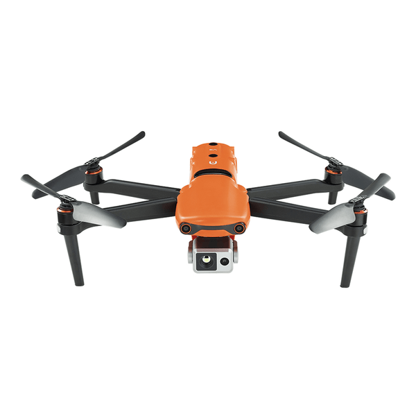
Autel EVO II 640T V3 and Autel EVO MAX 4T drones can be valuable tools for volcanic research and volcanic monitoring. Autel EVO II 640T V3 has a dual imaging camera, 8K visible light camera and 640*512 thermal imager.

Autel Robotics EVO II Dual 640T V3 Thermal Drone Rugged Bundle
$4799.00 USD
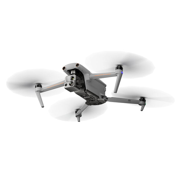
Autel EVO MAX 4T has a multi-sensor four-in-one camera, equipped with a wide-angle camera, zoom camera, thermal imager and laser rangefinder, with a flight time of up to 42 minutes, 720° obstacle avoidance, and is fully adaptable to a variety of complex environments.

Autel Robotics EVO MAX 4T Rugged Bundle
$8999.00 USD
Summary
Drones have made great contributions to volcano monitoring. They are mainly used for field and survey work, special operations, security, search and rescue. Drones are equipped with high-resolution cameras that can provide real-time aerial footage of affected areas. Law enforcement agencies can fully assess damage, monitor lava flows, and conduct search and rescue and scientific research.
Read More:
Autel Robotics EVO Lite+ Volcano Research Trip
Airplane Drone Situational Awareness in Extreme Environments


