Autel Evo II Pro RTK drone and Phantom 4 RTK drone are two of the most popular RTK drones on the market. They have excellent functions and performance, providing users with professional-level drone surveying and mapping services. This article will focus on these two drones and provide a detailed comparison and evaluation of them to help you better understand the features and benefits of these products.
Autel EVO II Pro RTK: Centimeter-level precision surveying and mapping drone
Autel EVO II Pro RTK drone has strong flight capabilities and reliable control system, and is compatible with a variety of sensors and mapping software. Using EVO II Pro RTK, users can easily create high-precision maps, 3D modeling and survey data to support a variety of application scenarios.

EVO II Pro RTK V3 is equipped with a 1-inch CMOS sensor, can shoot 6K video and 20MP photos, has a maximum flight time of up to 36 minutes, and is priced at $3800. RTK Horizontal Positioning Accuracy: 1cm+1ppm, RTK Vertical Positioning Accuracy: 1.5 cm+1ppm.
DJI Phantom 4 RTK Drone: High-precision surveying and mapping drone
The DJI Phantom 4 RTK Drone high-precision surveying and mapping drone has a built-in RTK positioning system and D-RTK 2 mobile base station, which can achieve centimeter-level precision measurement and mapping. In addition, Phantom 4 RTK also has advanced flight control technology and data processing capabilities, providing users with high-quality and efficient surveying and mapping solutions.

The DJI Phantom 4 RTK Drone is also equipped with a 1-inch CMOS sensor, takes 20MP photos and 4K videos, has a maximum flight time of up to 30 minutes, and is priced at $6,600. RTK Horizontal Positioning Accuracy: 1cm+1ppm, RTK Vertical Positioning Accuracy: 1.5cm+1ppm.
Autel EVO II Pro RTK VS Phantom 4 RTK Drone: Test Example
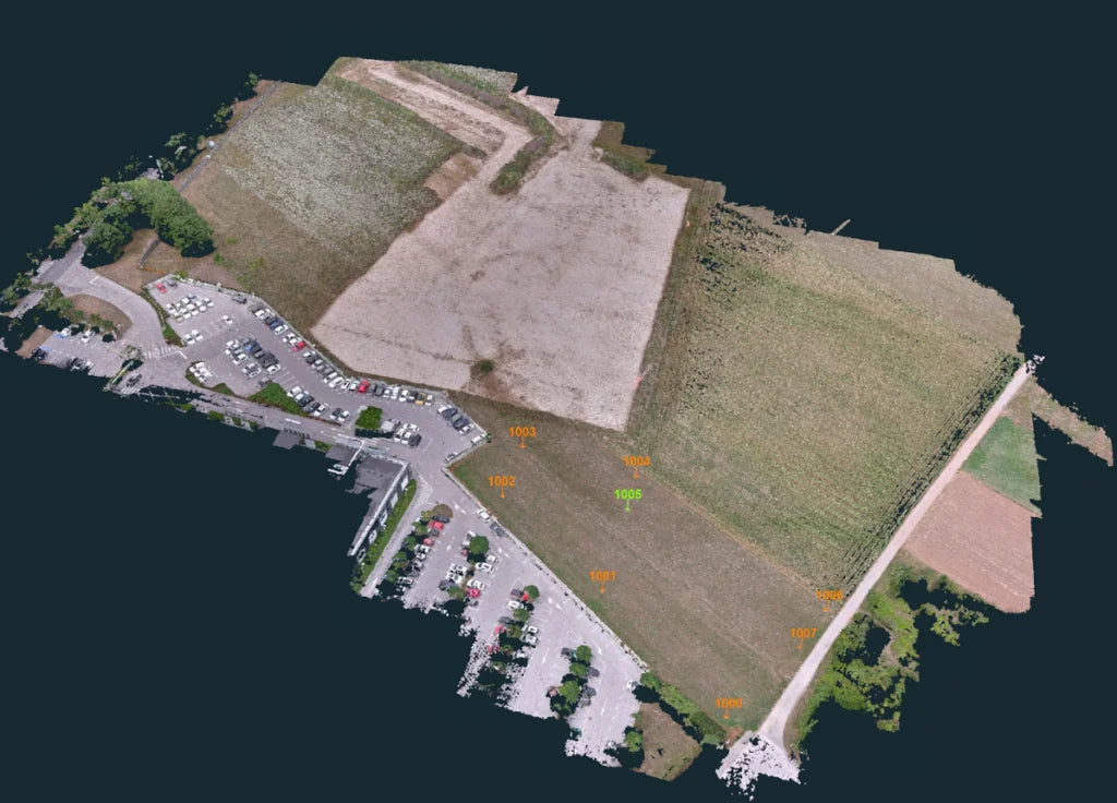
3Dsurvey tested the usability of the Autel EVO II Pro RTK and Phantom 4 RTK drones in a rural area of Portugal and at a timber company in Lithuania.
To measure accuracy, the company set up 1 Ground Control Point (GCP) and 4 verification points. In the separate verification of the EVO II Pro RTK drone, a single grid path was used. The drone shot along the established route by itself, then loaded the image in the 3Dsurvey software and imported the telemetry data. According to the finally generated point cloud accuracy data, the data difference does not exceed 5cm.

After testing the Autel Evo 2 RTK alone and getting good results, 3D Surveying compared it to the Phantom RTK drone. For the test, the two drones mapped an area of about 4.5 hectares. The 3D Surveying Company placed 1 ground control point and 7 verification points at the test site. A single ground control point was used to improve the accuracy of georeferencing, and seven verification points were used only for accuracy evaluation.
For each drone test flight, the 3D Surveying Company obtained the following results:
Evo 2 Pro RTK Drone Results:
| GCP | Height H [m] | Error |
| 10007 | 299.59 | 0.035m |
| 10006 | 299.60 | 0.035m |
| 10005 | 299.42 | 0.001m |
| 10004 | 299.41 | 0.015m |
| 10003 | 299.54 | 0.041m |
| 10002 | 299.72 | 0.020m |
| 10001 | 299.53 | 0.025m |
| 10000 | 299.56 | 0.025m |
The average error is 0.026m.
Phantom 4 RTK drone results:
| GCP | Height H [m] | Error |
| 10007 | 299.59 | 0.040m |
| 10006 | 299.60 | 0.012m |
| 10005 | 299.42 | 0.001m |
| 10004 | 299.41 | 0.009m |
| 10003 | 299.54 | 0.025m |
| 10002 | 299.72 | 0.014m |
| 10001 | 299.53 | 0.011m |
| 10000 | 299.56 | 0.014m |
The average error is 0.016m.
In conclusion
Of course, only one test comparison cannot evaluate the advantages and disadvantages of two drones. But based on error, both the Autel EVO II Pro RTK and Phantom 4 RTK Drone provide good enough accuracy to make very accurate measurements. So it all depends on your budget and preference.


