


Using drones for 3D mapping? This is real. Commercial drones are increasingly being used for 3D mapping.
3D modeling drones capture data from the air and can do many things that cannot be done with traditional surveying processes.
Document everything quickly and accurately, and with photogrammetry software you can stitch the data into an accurate 3D model.
What is drone 3D mapping and modeling?
Drone 3D mapping specifically refers to the process of drones capturing oblique images through laser scanning and aerial photogrammetry technology. 3D modeling, on the other hand, uses specialized software to analyze and process aerial images captured by drones to create 3D models with GPS coordinates and precise measurements.

What is a 3D model?
Create a 3D model by plotting points on the X, Y, and Z axes of 3D space to create a 3D representation of an object. These points are connected through different geometric forms, such as triangles, straight lines, curved surfaces, etc., to form a model.
Why use drone aerial photogrammetry?
UAV aerial photogrammetry is a new breakthrough in the traditional surveying and mapping industry. With the help of aerial drone situational awareness, it will be able to speed up the efficiency of surveying and mapping and increase production capacity.
Drones can easily capture data in areas that are difficult to reach or unsafe for surveyors, reducing GCP point placement. It can quickly record in places with severe landslides, road tunnel construction, difficult-to-navigate terrain and severe weather conditions, reducing the potential risk index for surveyors.

UAV drone aerial photogrammetry mapping solution needs to be equipped with a high-resolution camera, long-distance lossless zoom shooting, and enable centimeter-level RTK/PPK functions. UAVs can provide high-precision measurement results.
Are drone images reliable for creating 3D models?
Drone 3D models are very reliable because the drone records a large amount of precise and repetitive data in the air, allowing for multi-angle shooting of even the smallest details. Converting drone photography photos into 3D models or maps has many advantages such as low cost, short cycle, timely data update, and reduced labor costs, and has been widely used in various application scenarios.
What kind of drone is suitable for 3D mapping and modeling?

3D mapping and modeling drones tend to be GIS surveying, centimeter-level positioning accuracy, integrated RTK and PPK modules, large-size camera sensors, excellent flight performance, long-term endurance, load capacity, etc. .
Check out the best surveying and mapping drones for sale, targeting applications such as terrain mapping, power, emergency services, construction, transportation and agriculture.
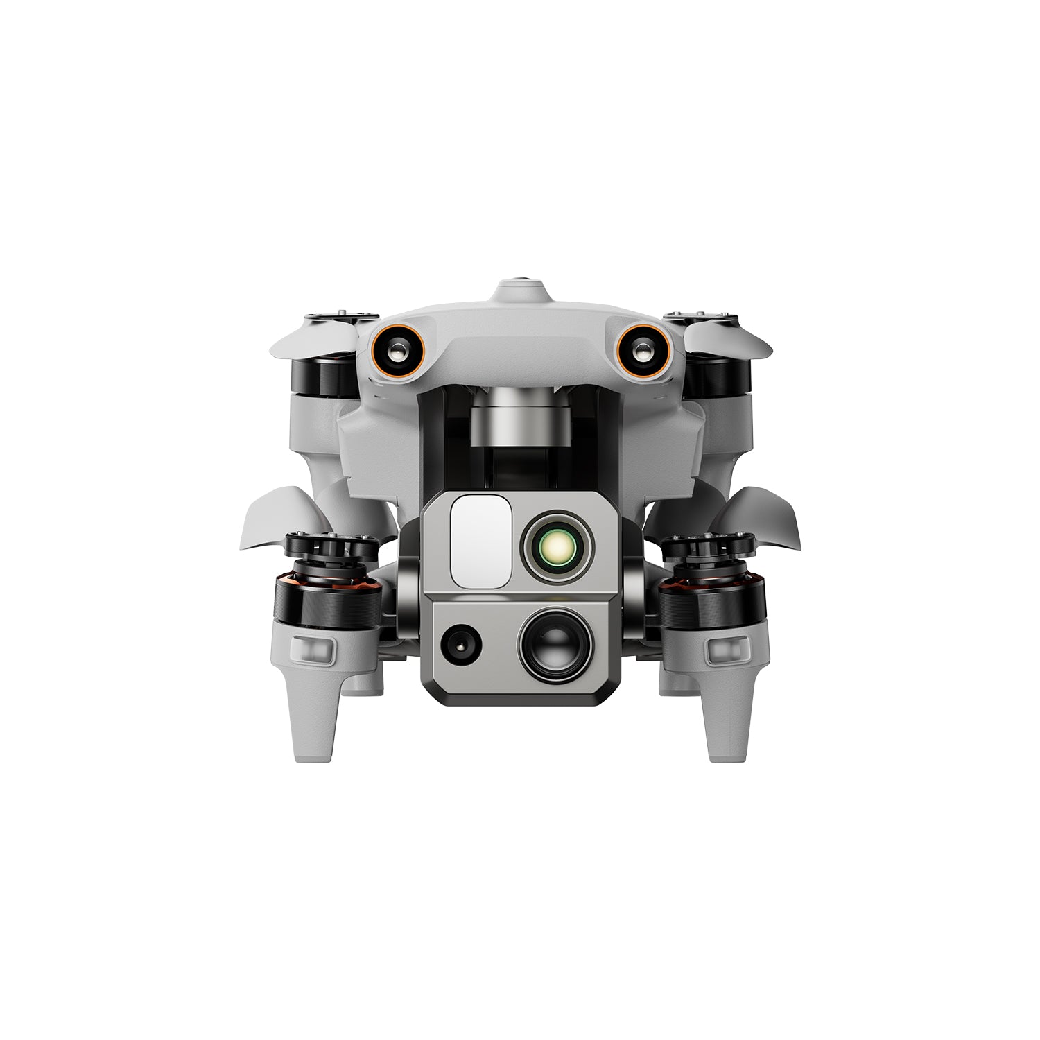
Autel Robotics EVO Max 4T
$8999.00 USD
640*512 Thermal Camera | 1.2km Laser Rangefinder | 50MP Wide Camera | 160x Zoom Camera Buy Now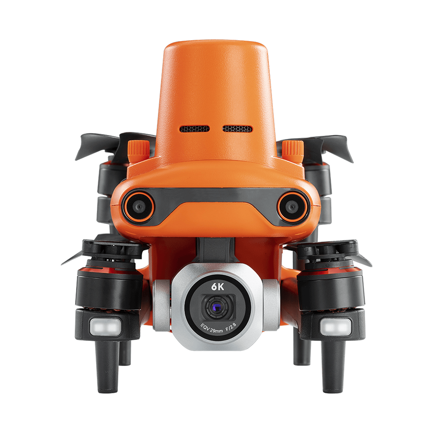
Autel EVO II PRO RTK V3
$2,999.00 USD
1" CMOS Sensor | 6K 20MP Camera | 40 Mins Flght Time | 15KM Video Transmission Buy NowThe best drone 3D modeling software
UAV 3D modeling software can quickly and effectively process UAV image data to obtain models. Surveyors can choose modeling software produced by drone companies to use in combination with drones of the same brand.
Surveyors can also use popular and widely used third-party software such as Pix4D, Agisoft Metashape, and DroneDeploy.
 Autel Robotics and DJI Drone companies have their own modeling software, Autel Mapper and DJI GS Pro. The modeling software offers point cloud editing, orthophotos, image stitching, 3D model generation, and more, making it suitable for both beginners and professionals.
Summarize
3D mapping and modeling drones are a technology that uses sensors and cameras mounted on drones to obtain real-world geographical information data through aerial photography technology, and uses these data to generate three-dimensional models and maps.
This kind of drone can quickly and efficiently obtain the geometric structure and feature information of the surface, providing important data support for urban planning, land management, architectural design, resource exploration and other fields.
Related More:
Drone Mapping: LiDAR Technology
Drone Mapping: RTK VS PPK VS GCP
PPK VS RTK – Which is the Best Mapping Drone Technology?
Autel EVO II Pro RTK Drone Mapping and Surveying: All You Need To Know


